DTN uses a RouteNetwork (in partnership with ChartWorld). The Route Network is a worldwide network of waypoints and leg-lines; it provides for tracks within Restricted Routing Areas and allows to implement own routing and optimization strategies in Unrestricted Routing Areas.
Diverse Data Sources:
It leverages a variety of sources:
- Bathymetry
- Charts
- Sailing Directions
- NavAreaWarnings
- T&P Notices
- Local Authorities’ Data
Data Enrichment:
The data is continuously enriched and updated to maintain accuracy and relevance by a group of experience Navigators and Master Mariners.
Data Quality Assurance:
Implemented data quality checks to ensure the reliability of information.
Historical Data Analysis:
Analyzation of historical AIS data for route quality optimization.
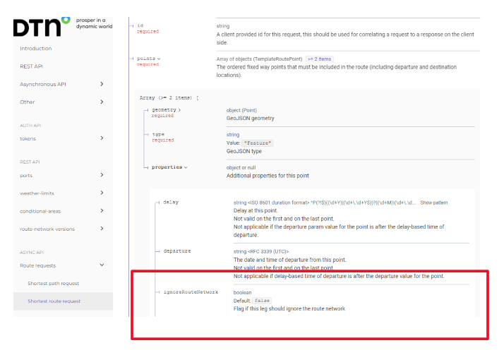
Our advice (for true weather optimization) is to not use the “ignore route network”-flags during the long ocean crossings and only supply a departure and destination. The settings to toggle the RouteNetwork can be found under ‘route request – type of request – points – properties (see screenshot)

The routing algorithm will use the RouteNetwork based on vessel specifics. If you still think that the route isn’t feasible for the vessel, you have the option to block this route by closing the via/no go areas.
That way the route won’t be able to pass via the original route but will find the most optimum route avoiding this route. This is in general the solution if the API returns a route that isn’t deemed feasible for a specific vessel.
